


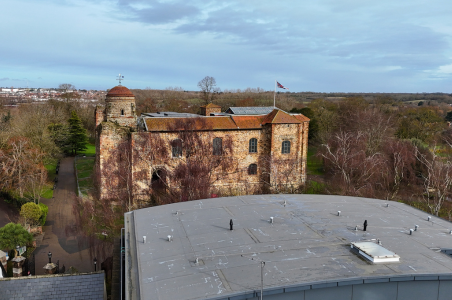
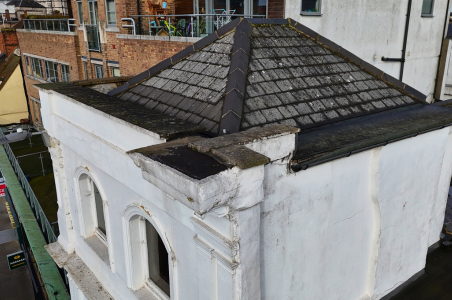
Our Colchester-based surveying team recently took to the skies to complete a high-resolution drone survey of Colchester High Street, capturing detailed aerial imagery to support planned works in the area.
With our in-house drone pilots and advanced surveying equipment, our team can quickly, safely, and with minimal disruption, inspect hard-to-reach areas, providing a smarter and more efficient way to gather critical data.
Drone surveys are now a key element of our building surveying and asset management services, providing clients with rapid, accurate insights to inform better decisions.
From roof inspections and building assessments to large-scale site mapping, we’re transforming how surveys are delivered, from the ground and the air.
Click here to discover more about our drone surveying services and how they can support your next project.


 General Enquiries
 Twitter
 LinkedIn
 Instagram